


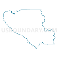
Voting District 31760, Santa Clara County, California
About
Outline

Summary
| Unique Area Identifier | 543398 |
| Name | Voting District 31760 |
| County | Santa Clara County |
| State | California |
| Area (square miles) | 1.97 |
| Land Area (square miles) | 1.55 |
| Water Area (square miles) | 0.43 |
| % of Land Area | 78.26 |
| % of Water Area | 21.74 |
| Latitude of the Internal Point | 37.42132640 |
| Longtitude of the Internal Point | -121.98658490 |
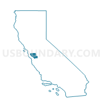
Maps

Graphs
Select a template below for downloading or customizing gragh for Voting District 31760, Santa Clara County, California


Neighbors
Neighoring Voting District (by Name) Neighboring Voting District on the Map
- Voting District 20720, Alameda County, CA
- Voting District 31590, Santa Clara County, CA
- Voting District 31595, Santa Clara County, CA
- Voting District 31600, Santa Clara County, CA
- Voting District 31605, Santa Clara County, CA
- Voting District 31670, Santa Clara County, CA
- Voting District 31735, Santa Clara County, CA
- Voting District 31765, Santa Clara County, CA
- Voting District 31770, Santa Clara County, CA
- Voting District 42545, Santa Clara County, CA
- Voting District BAY, Alameda County, CA
Top 10 Neighboring County Subdivision (by Population) Neighboring County Subdivision on the Map
Top 10 Neighboring Place (by Population) Neighboring Place on the Map
- San Jose city, CA (945,942)
- Fremont city, CA (214,089)
- Sunnyvale city, CA (140,081)
- Santa Clara city, CA (116,468)
Top 10 Neighboring Elementary School District (by Population) Neighboring Elementary School District on the Map
- Sunnyvale Elementary School District, CA (85,145)
- Mountain View Whisman Elementary School District, CA (65,635)
Top 10 Neighboring Secondary School District (by Population) Neighboring Secondary School District on the Map
- Fremont Union High School District, CA (223,745)
- Mountain View-Los Altos Union School District, CA (106,288)
Top 10 Neighboring Unified School District (by Population) Neighboring Unified School District on the Map
- San Jose Unified School District, CA (251,156)
- Fremont Unified School District, CA (214,089)
- Santa Clara Unified School District, CA (143,808)
Top 10 Neighboring State Legislative District Lower Chamber (by Population) Neighboring State Legislative District Lower Chamber on the Map
Top 10 Neighboring State Legislative District Upper Chamber (by Population) Neighboring State Legislative District Upper Chamber on the Map
Top 10 Neighboring 111th Congressional District (by Population) Neighboring 111th Congressional District on the Map
- Congressional District 15, CA (677,605)
- Congressional District 13, CA (665,318)
- Congressional District 14, CA (653,935)
Top 10 Neighboring Census Tract (by Population) Neighboring Census Tract on the Map
- Census Tract 5050.01, Santa Clara County, CA (9,741)
- Census Tract 4415.03, Alameda County, CA (5,389)
- Census Tract 5046.02, Santa Clara County, CA (2,144)
- Census Tract 9900, Alameda County, CA (0)